
Start a Broomfield Resident Search
Broomfield has no single public roll that names every person living within the city and county. A useful residents directory is assembled from record sets with different purposes. The assessor shows a parcel owner, mailing address, legal description, and tax history. The Colorado Secretary of State verifies a registration match with a name, ZIP, birthday, and CAPTCHA. Deeds show parties to a recorded instrument. A directory or newspaper can place a household at an address in an earlier year.
Start with the clue that is already in hand. An address points to an assessor account and GIS parcel. A full name can lead to voter verification, a court docket, a professional license, or a business filing. A family-history question usually starts with a library, cemetery, newspaper, or historical directory. None of these alone proves present occupancy. Dates, jurisdiction, legal descriptions, and the custodian's access rules matter.
- Search the Broomfield assessor by owner, situs address, parcel, legal description, or ZIP, then save the account and parcel numbers.
- Use the Colorado voter verification form for one person with first name, last name, ZIP, birthday, and the required CAPTCHA.
- Search the Broomfield Recording Division index for deeds, liens, plats, easements, and related instruments.
- For an earlier household, compare a telephone book or criss-cross directory with census, newspaper, cemetery, and probate clues.
- When an online result is missing, ask the correct custodian through a court request, CORA request, library route, or former-county archive.
Note: A matched name is a lead until a second dated record ties it to the right address, parcel, event, or jurisdiction.
Where Broomfield Keeps Resident Records
The City and County of Broomfield combines city and county functions, but its records remain divided by record type. The Clerk and Recorder handles recording, elections, marriage licensing, motor-vehicle services, and Council-clerk work. The Assessor keeps parcel accounts. The Elections Division routes registration and election data. The courthouse and HHS are separate custodians.
City and County Recording Division
One DesCombes Drive
Broomfield, CO 80020
303-464-5109
Broomfield Assessor
City and County of Broomfield
Broomfield, CO 80020
303-469-3301
Broomfield Elections Division
One DesCombes Drive
Broomfield, CO 80020
303-464-5857
The Clerk and Recorder's public role does not turn every function into a searchable resident directory. A city staff listing identifies a department contact, not a person's residence. A marriage-license or deed index identifies an event or instrument. The assessor's owner mailing address is separate from the situs address. Keeping those distinctions visible prevents a convenient record from being stretched into a claim it cannot support.
For a courthouse question, Broomfield Municipal Court handles local parking, traffic, animal, code, and misdemeanor matters, while Broomfield Combined Courts sits in the 17th Judicial District. The local court and statewide request form have different records and access rules. A birth or death certificate goes to Broomfield HHS or CDPHE, with proof of identity and a qualifying relationship or direct and tangible interest.
Broomfield's Clerk and Recorder overview shows why a name search must be routed by record series. The office is a door to several systems, not a replacement for each system.
The official Clerk and Recorder page supplies the local office context for this combined function.
The office image shows the public-record, election, licensing, and Council-clerk functions that must be routed separately.
Broomfield's Four-County Records Boundary
Broomfield became a city and county on November 15, 2001. Before that conversion, the territory belonged to Adams, Boulder, Jefferson, or Weld County record systems. That legal history is the main local fact behind an older Broomfield residents directory search. A deed, census entry, directory listing, or court lead dated before the county's creation may carry a different county label even when the place is now inside the same city boundary.
Use the current parcel and legal description as the bridge. Do not stop at a modern street string when an older instrument is missing. The former county may hold the book, index, microfilm, or archive. The same boundary issue appears in historical directories, because Broomfield can appear within Boulder-area listings rather than in a standalone Broomfield volume.
- 1961: Broomfield incorporated as a city, with later annexations changing the local map.
- 1969-1972: Annexation and planned-community growth extended the city into areas tied to older county labels.
- 1988-1989: Northern expansion reached territory associated with Weld County records.
- November 15, 2001: The consolidated City and County of Broomfield began its present county record layer.
For the background chronology, the official Broomfield identity page and the city's history record supply the boundary context.
The official identity page is also the source behind this Broomfield residents directory location story. A place name is not always a custodian name.
Broomfield's city and county profile puts the consolidated boundary in context before a researcher follows a pre-2001 record trail.
Note: A missing pre-2001 Broomfield result usually calls for a former-county search, not a conclusion that the record was never created.
The historic boundary image from Broomfield's official profile gives useful local context for a residents directory search.
The image belongs with the boundary question: present-day city and county services sit over a record history that crosses four former counties.
The chronology in Broomfield's history source adds the local development and transportation context that helps interpret older directory and census labels.
That historical layer is a useful check before treating a county label as a different place.
Search the Broomfield Assessor
The Broomfield EagleWeb Assessor is the strongest current address-to-owner starting point. Search by account, parcel, owner, business name, subdivision, lot, block, tract, unit, situs address, ZIP, tax area, property use, classification, value, square footage, year built, bedrooms, or bathrooms. A guest can view the public account card; the card may include owner, mailing address, every situs line, legal description, tax area, values, exemptions, improvements, land, transfers, tax history, and map links.
The field mix makes a Broomfield residents directory search more careful than a name-only lookup. The sample account for One DesCombes Drive showed three situs lines and a separate owner mailing address. It also showed a municipal parcel and a second solar account at the same situs. Group search results by parcel and account before reading them as separate households.
| Search group | Fields captured | Useful handoff |
|---|---|---|
| Owner and business | Last/first name, business name, normal or advanced mode | Test the name against deeds or another dated source. |
| Situs | House number, extent, street, designation, direction, unit, ZIP | Open the account and copy every situs line. |
| Legal description | Subdivision, lot, block, tract, unit, section, township, range | Use the same description in EagleWeb Recorder. |
| Property details | Use, classification, value, acres, square footage, year built | Use as parcel context, not as proof of residence. |
Assessed value is an assessment figure, not a market opinion. Older records are incomplete in the current county system because Broomfield was formed in 2001. Mineral rights also require deed research. The official assessor search is the correct place to test an address, while the Assessor can help with a technical search problem by phone or email.
Broomfield Parcel Maps and GIS
The assessor supplies the account. Broomfield GIS supplies the map-to-parcel bridge. Search a complete address in the parcel viewer, accept the autocomplete suggestion, click the parcel, and follow the assessor link. Layers can add the Broomfield boundary, address-notification parcels, zoning, planned developments, floodplains, planning areas, urban-renewal areas, wards, precincts, roads, buildings, and utilities.
The Planning Research Map adds a neighbor workflow. A selected parcel can be surrounded with a green buffer, a distance can be drawn, nearby addresses and parcels can be returned, and the selected set can be exported as a CSV. A single-point selection is better for one parcel. A shape or intersection tool fits an irregular block. Parcel lines are approximate and are not a legal survey.
For a resident directory, GIS is a discovery tool. It shows which parcel to open, whether a common tract sits beside a home, and which ward or plan area frames the address. The assessor and recorder remain the sources for ownership and recorded parties.
Note: A GIS neighbor is a map relationship; verify the parcel account, legal description, and record date before calling it an ownership relationship.
Broomfield Voter Verification Limits
Colorado voter verification is person-specific. The public form asks for first name, last name, ZIP, birthday in MM/DD/YYYY form, and a Google reCAPTCHA. If a recent move is not found, the official instructions say to try a prior ZIP or contact the county election office. Confidential voters and preregistrants under 18 may not appear.
Colorado law makes several registration categories public, including full name, residence and mailing address, year of birth, party affiliation, voting history, active or inactive status, and military or overseas flag. Social Security number, driver's-license number, month and day of birth, signature, and email remain confidential. The form uses a full birthday for matching, but that does not make the full birthday a public result.
The Broomfield Elections Division also publishes dated files such as EX-003 registered voters, EX-005 voting history, VR-009 counts, and ballot-status files. A broader file request uses the Secretary of State form and its purpose, delivery, payment, and security certifications. It is not a public street browse.
Broomfield election data is the source for the dated file catalog and office route.
The election image reinforces the distinction between a dated public file and an always-current household list.
Current Broomfield Directory Sources
Current records answer different questions. A parcel card identifies the named owner and tax context. A recorded document identifies parties to an instrument. A voter match confirms a registration record under Colorado's public and confidential field rules. A business filing or professional license shows a public affiliation, not a residential fact. The right source depends on the question and the date.
| Source | Record signal | Keeper | Access note |
|---|---|---|---|
| Assessor account | Owner, mailing address, situs, parcel, transfers | Broomfield Assessor | Guest search; current county-era data |
| Recorder index | Grantor, grantee, document, date, legal description | Recording Division | Free index; copies and certification separate |
| Voter verification | One registration match and public categories | Colorado Secretary of State | Name, ZIP, birthday, CAPTCHA |
| Business filing | Entity status, agent, principal or mailing address | Colorado Secretary of State | Filing role is not residence proof |
| Professional license | License type, number, status, discipline | Colorado DORA | Public status; location needs care |
- Roll
- A list kept for a defined public purpose, such as property assessment or voter registration.
- Index
- A finding aid that points to a recorded document or case; it is not always the document image.
- Criss-cross directory
- An address-first historical directory that reverses the usual name search.
- Parcel
- A mapped and assessed land unit tied to an account and legal description.
| Official custodian record | Commercial compilation category |
|---|---|
| Names the record series, date, fields, custodian, and access rule. | May combine old filings, listings, and licensed data with unclear dates. |
| Offers a reproducible portal, request form, office contact, or collection citation. | May conflate same-name people, charge for access, or use a separate opt-out process. |
The Colorado Secretary of State business search accepts entity name, trademark, trade name, ID, and document number. A result can expose status, formation date, principal and mailing addresses, registered agent, trade names, and filing history. The state business search is useful when a resident clue is tied to a public organization.
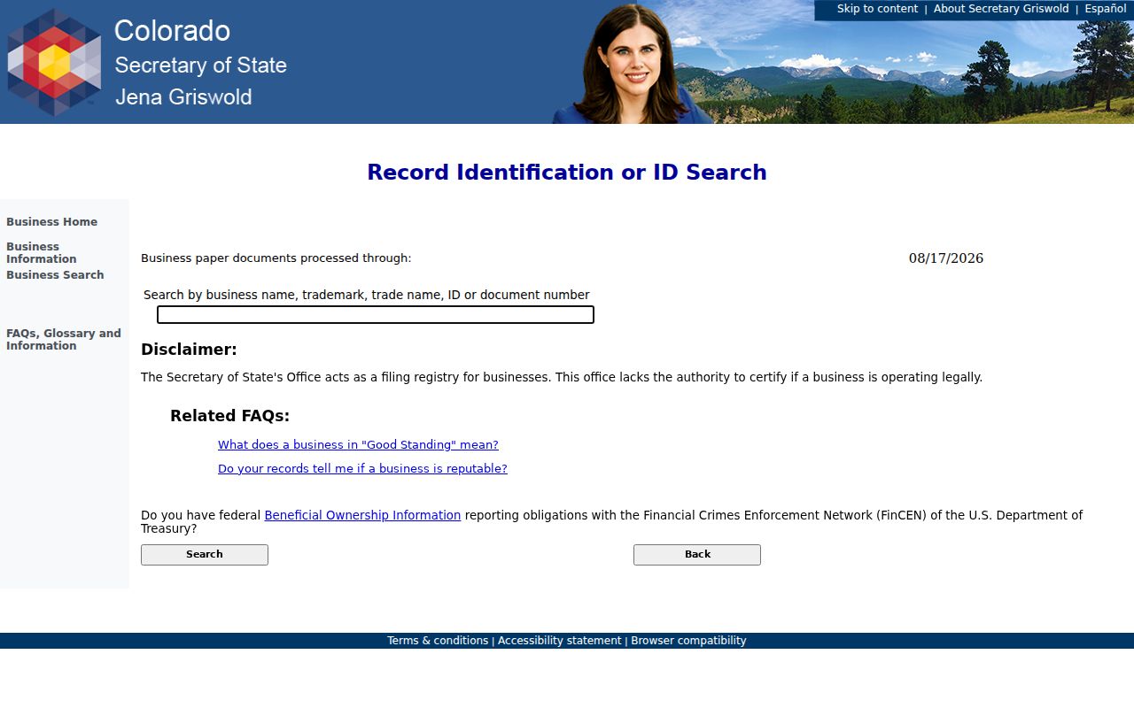
Use that filing layer as an affiliation check, then return to a parcel, court, or historical source for the resident question.
Broomfield Deeds as a Resident Trail
The Broomfield Recording Division indexes documents recorded from November 15, 2001. Its search form supports document number, recording dates, grantor, grantee, both names, marriage dates, subdivision, lot, block, tract, unit, quarter section, section, township, range, and document type. One search may combine several fields. A wildcard is available, and related searches can find records that share a legal description or link to the open document.
A deed gives a grantor, the person or entity transferring an interest, and a grantee, the person or entity receiving it. A legal description identifies the land by subdivision, lot, block, tract, or survey. Copy the legal summary, document number, recording date, parties, and deed type. Search the grantee as a later grantor to move backward. At the county boundary, shift to Adams, Boulder, Jefferson, or Weld.
The current schedule effective June 1, 2026 lists a $43 general recorded document fee, $0.25 per page for a copy, and a $1 certification charge per document, with separate UCC, marriage, and documentary-fee rules. The office will not conduct the search for a requester under C.R.S. 30-10-101(2.5)(c), so provide a name, date range, document number, parcel, or legal-description lead.
Broomfield Recording explains the index, office route, self-service tools, and coverage caution.
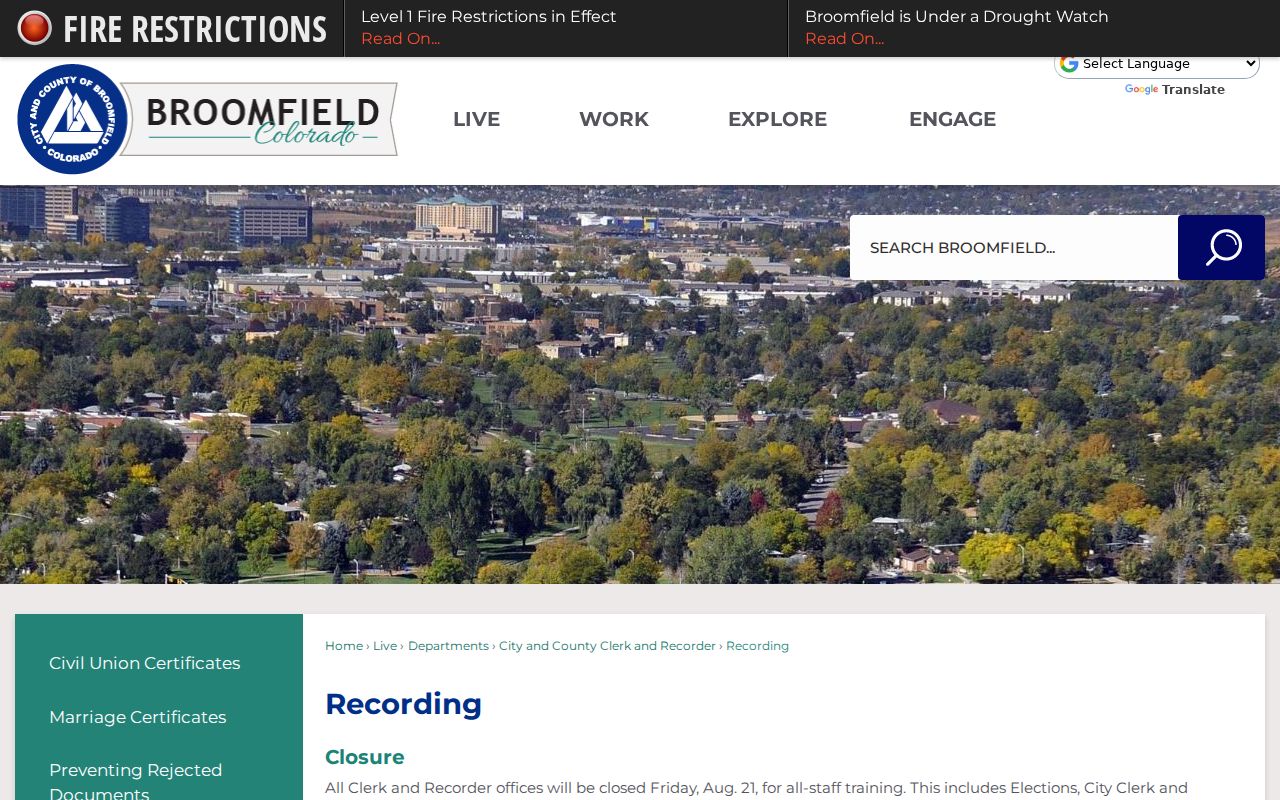
The recording screenshot belongs beside the deed-chain method because the instrument index is the bridge from one parcel owner to an earlier recorded party.
Broomfield Courts and Vital Records
Courts can locate a person in a dated case setting, but a docket hearing is not proof of residence, liability, or outcome. The Colorado Judicial Branch docket form accepts county, courthouse, court type, division, date range, case class, case number, party, and attorney filters. A captured Broomfield search returned 623 results for a one-week window and displayed date, time, duration, case number, hearing, location, appearance, and courtroom.
Broomfield Combined Courts is at 17 DesCombes Drive in the 17th Judicial District. The statewide court records request form asks for name, case number, year, county, date of birth, party information, document categories, and certification choice. Municipal Court has a separate records and forms route for local matters. Restricted, sealed, juvenile, adoption, protected domestic, and confidential probate material may not be open by name.
Vital records are even narrower. Broomfield HHS and CDPHE do not provide an unrestricted current birth or death name index. A certified copy requires identity and a qualifying relationship or direct and tangible interest under C.R.S. 25-2-117 and 5 CCR 1006-1. Birth records at least 100 years old can enter the Colorado State Archives research route.
Colorado's docket search supplies the official court interface and hearing fields. The local Broomfield Municipal Court services page supplies the municipal route.
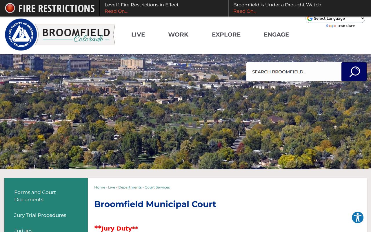
The court image is a reminder to request the case document itself when a docket line is not enough.
Broomfield's 1960 Telephone Directory
Historical resident research gains a concrete local anchor from the Spring 1960 Broomfield Telephone Directory in Broomfield History Collections. The catalog identifies Mountain States Telephone & Telegraph as publisher, object ID 2016.2.3, and the locality as Broomfield, Broomfield Heights, and East Lake. The physical booklet is a 6 by 9 inch stapled object.
Telephone books usually show a surname or household name, address, and telephone number. They can also separate business and institution headings. They do not automatically list every person in a home, and spouse, occupation, or owner marks should not be assumed from a telephone entry. The Library of Congress selected runs add 1944, 1945, 1946, 1948, 1950, 1958, 1960, 1970, and 1974 local books.
For street-order work, Denver Public Library's criss-cross run covers a broad 1924 to 2018 range, with a digital 1924 to 1937 subset. Broomfield inclusion must be checked volume by volume. A directory absence can mean a move, an unlisted number, a gap in coverage, or a locality heading that sits inside a broader Boulder or Denver book.
Broomfield ZIP Geography
The official Broomfield ZIP map shows 80020, 80021, 80023, 80026, 80027, 80234, and 80516. Postal areas do not equal the city boundary, and the map is not a substitute for a USPS response or parcel boundary. ZIP is a useful filter, not a complete definition of who lives in Broomfield.
Map-served ZIPs: 80020 marks the central and historic core; 80021 covers west and southwest portions; 80023 covers north and east growth areas; 80026 appears on the northwest edge; 80027 sits in the southwest and southern map context; 80234 reaches the southeast and Adams-side postal geography; 80516 appears on the northeast and east edge.
Research caution: Confirm the exact situs in the current record. Postal and municipal lines can diverge, and 80026 is shown on the official map but absent from the current assessor control.
In the assessor's current ZIP control, 80026 is absent while the other six map-served values are exposed. The USPS address lookup, GIS boundary, assessor situs, mailing address, and legal description can describe overlapping but different geographies.
Broomfield Privacy and Safe Use
Some people will not appear in a public Broomfield residents directory. Colorado's Address Confidentiality Program provides a substitute address and mail forwarding for eligible survivors. Broomfield voter confidentiality can remove a qualified person's address from future lists, although the city says past lists are not retroactively removed. Vital, court, juvenile, sealed, suppressed, and sensitive police records have separate protections.
Colorado's privacy law gives covered consumers access, correction, deletion, and opt-out rights with private businesses, while a recorded deed, voter file, or court record remains governed by the custodian's own statute and retention rules. A public-record correction goes to the assessor, recorder, elections office, court clerk, HHS, CDPHE, or police unit that created the record.
Lawful personal use. Broomfield records support family history, civic research, reconnecting, and personal record checking. Do not use a name or address trail to stalk, harass, intimidate, or harm anyone.
The Colorado Attorney General's universal opt-out information explains Global Privacy Control for covered private businesses. That option does not erase a public deed or court file.
Broomfield Libraries, Museums, and Cemeteries
The public library supplies a human layer that a tax roll cannot. Broomfield Public Library links the Colorado Historic Newspapers Collection, Broomfield Enterprise, Denver Post, Ancestry Library Edition, MyHeritage, and museum material. The library is at 3 Community Park Road, with the listed hours of Monday through Thursday 9 to 9, Friday and Saturday 9 to 5, and Sunday 1 to 5.
Broomfield History Collections at 6 Garden Center and the Depot Museum preserve photographs, directories, objects, and local research. CatalogIt item records can lead to a family report, a telephone book, a place name, or a researcher contact. Lakeview Cemetery adds an older trail: its earliest burial is October 1888, it was incorporated in 1890, traditional burials ended in 1954, and cremation interments began in 1992. County Commons begins a newer phase in 2003, with Phase 2 completed in 2018.
The city did not locate a complete public cemetery-name index or a single citywide resident directory. Ask the library, museum, cemetery staff, or a named custodian for a targeted search with a person, lot, date, school, event, or address. A dated newspaper notice can guide the request without replacing a certified record.
Broomfield's online library resources show the database and local-history routes.
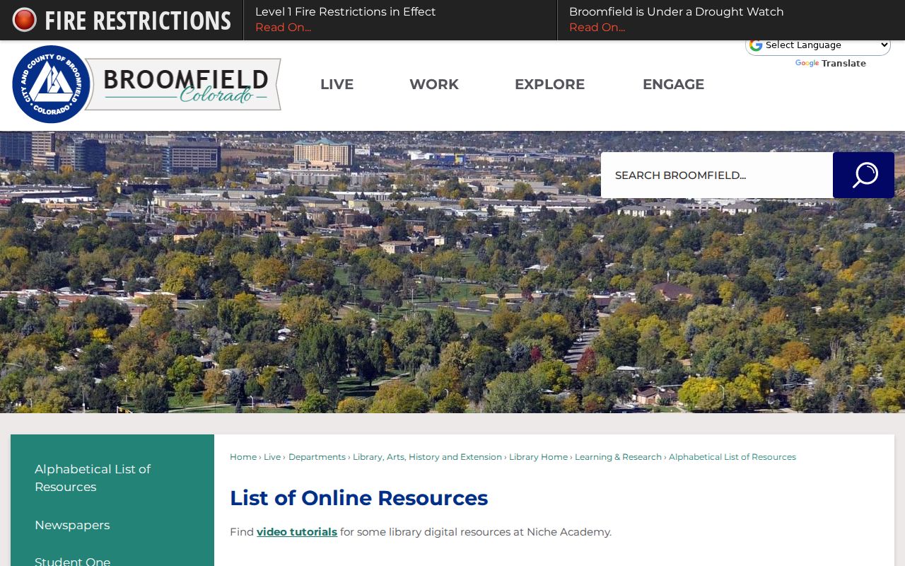
The library image connects current lookup work to newspapers, genealogy databases, and local collections that can explain an older name or address.
Broomfield's Historical Directory Shelf
A historical Broomfield residents directory is a shelf of partial runs, not one uninterrupted book. The 1960 local telephone directory, Library of Congress telephone books, 1926 through 1932 Boulder-area directory references, Denver Public Library's broad directories and criss-cross volumes, newspapers, census schedules, and museum objects each cover a different slice.
Pair an address with a name and year. Then compare the directory entry with a deed, census household, obituary, cemetery record, or probate file. A telephone subscriber is not every occupant. A city directory may add occupation or household clues, but a missing name is not proof of absence. A legal description can bridge a street label that changed or a county label that predates Broomfield County.
The full collections workflow, including the local 1960 catalog item and the broader reverse-directory shelf, is on the Broomfield city directory page. This is the historical end of the Broomfield residents directory trail, where a modern parcel record becomes a family or place-history question.
Note: Record the exact volume, locality heading, page, and publication year so another researcher can reproduce an older directory result.